Objectives
Objectives
Snow properties related to snow grain size and type at the surface are of special interest within the field of avalanche research and warning. In continental and inter-mountain avalanche climates weak layers or interfaces of the snow pack are the main cause of avalanches. Knowledge about such weak layers helps to increase the precision of avalanche forecasting. Some of these potential weak layers, such as surface hoar, form on the snow surface where they are preserved until burial. Optical satellite sensors measure reflected sunlight at different wavelengths in the visible and infrared part of the electromagnetic spectrum. The near-infrared region is sensitive to the optical grain size of the snow. Due to the distinct size and shape characteristics of potential weak layers such as, for example, surface hoar, their reflectance is quite different from other types of snow, such as new snow or melting snow. If the weather permits optical observations it should, therefore, be possible to detect such layers by remote sensing. The focus of this pilot study is the simultaneous collection of in situ data and the acquisition of satellite data in order to establish a relationship between avalanche-relevant variables and variables retrieved from the remote sensing data. Specifically, in situ measured surface snow grain characteristics are compared to snow grain characteristics as derived from multispectral data from the MODIS satellite sensor.
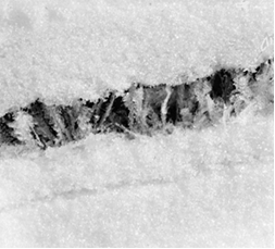
A weak snowpack layer of buried surface hoar (photo: University of Calgary).