Some results
Some results
Lake Ice Cover product
This product makes use of the MERIS and AATSR sensors on the ENVISAT satellite. MERIS has 15 spectral bands in the visible and near infrared wavelengts, allowing good spectral discrimination between endmembers. Its spatial resolution is 300 meters. AATSR has 7 bands, including 3 bands in the thermal wavelengths, and is thus used for detection and masking of clouds. The lake ice cover product is in geographical coordinates (latitude/longitude grid) with a resolution of 0.0025 × 0.0025 degrees.
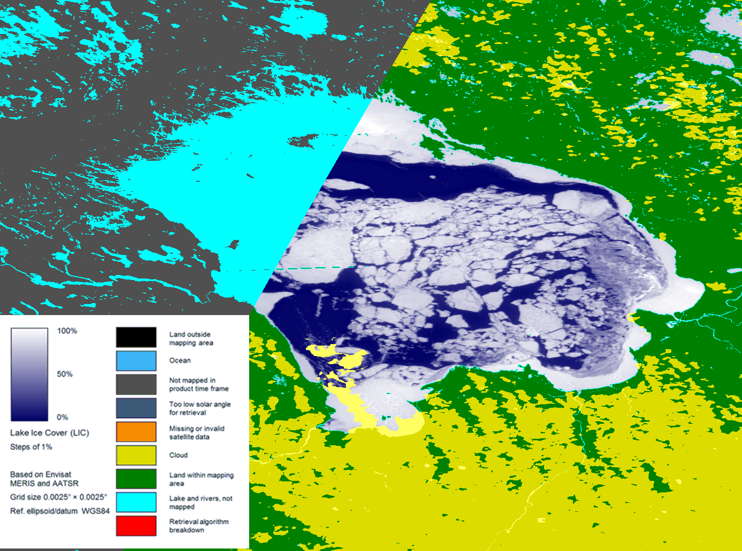
Lake Ice Cover product for Lake Ladoga (March 22, 2009).
Lake Surface Temperature product
The lake surface temperature product is derived from the thermal bands of the AATSR sensor onboard ENVISAT, providing 1 km spatial resolution. The algorithm of Key et al. (1997) is used to retrieve the surface temperature from the AATSR data. Clouds are also detected and masked in the product. The lake surface temperature product is in geographical coordinates (latitude/longitude grid) with a resolution of 0.0025 degree resolution.
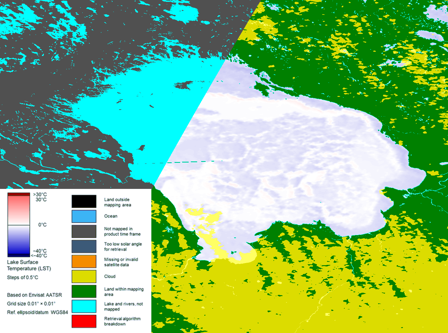
Lake Surface Temperature product for Lake Ladoga (March 22, 2009).