Some results
Some results
Results from the adaptive region and method selection
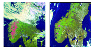
The following illustrates the performance of the adaptive image registration for a pair of NOAA-AVHRR images taken over the southern part of Norway. In the image to the left in Figure 1 the mountain areas in the south are still covered with snow (red), while there are a lot of clouds further north. In the image to the right this snow has melted. There is also much less clouds in this image. Hence, the region selection should here need to select areas that are not covered by clouds. Also, the regions over the sea are not well suited for registration and should not be selected.
In Figure 2 the regions selected for the image pair in Figure 1, when using the adaptive registration, are showed. The superimposed grid shows the division into sub-regions, and the regions marked with yellow shows the regions that were selected using two different parameter settings for region density. As can be seen from this result, the adaptive registration has selected regions over the parts that are not covered by clouds and it has also ignored sub-regions only containing sea.
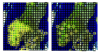
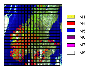
Figure 3 illustrates which method that was selected for each region, where each sub-region is colour-coded according to which method that was applied for that region. As can be seen from this illustration, the method selected most often is method number 4. This method consists of a mutual information metric in combination with an evolutionary-based optimizer. This combination of methods is able to handle complex correspondence between image values and is also the one that is most tolerant to noisy metrics. Hence, it is well suited for an image pair like this where the differences are quite large.