Some results
Some results
- Automatic co-registration of repeated acquisitions of the same area
- Automatic change detection in cloud-contaminated optical satellite images
Automatic co-registration of repeated acquisitions of the same area
The automatic coregistration method has been applied on 14 repeated Landsat 5 TM acquisitions of the same scene: path 227, row 062. 12 of the acquisitions were coregistered with subpixel accuracy. The remaining two acquisitions were coregistered with errors within 1-2 pixels.
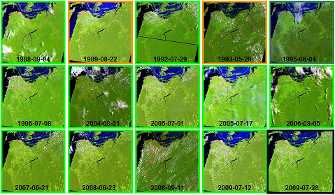
The 14 images (green and orange frames) were coregistered to the reference image (black frame). The green frames indicate subpixel accuracy, and the orange frames indicate 1-2 pixel errors.
To get a visual impression of the coregistration accuracy, mosaics of two images in a 3x3 checkerboard pattern have been made.
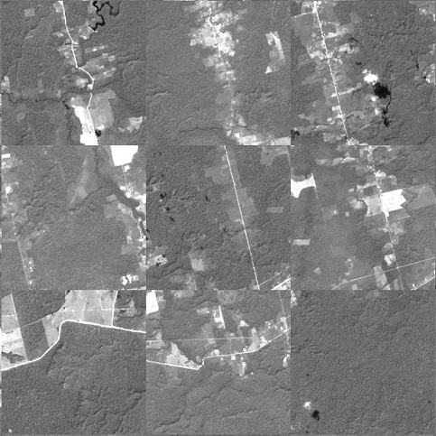
Mosaic of parts of two images, acquired on 31 August 2004 and 28 July 2009, before automatic coregistration was applied.
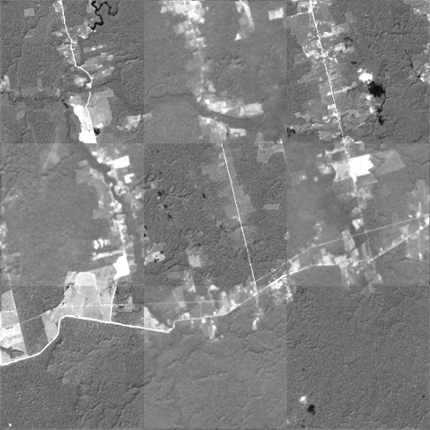
Mosaic after automatic coregistration was applied. The roads are now perfectly aligned.
Automatic change detection in cloud-contaminated optical satellite images
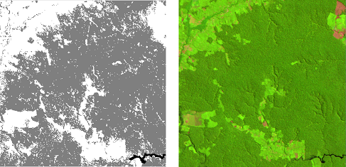
The automatic change detection method was applied on a time series of 24 acquisitions of Landsat scene 227-062. The method identifies the time interval for each detected change. As a by-product, forest / non-forest cover maps are generated from the change detection process (and not the other way around). Since this is an area in which forest is being clear cut and transformed into agricultural land, we did not allow for regrowth in the specific model that was used for change detection.
DISCLAIMER: Please note that the results shown here have not been verified with in-situ data or very high resolution satellite images, so they have an unknown misclassification rate.
Left: forest / non-forest map, 29 July 1986. Right: Landsat 5 TM image of the same date.
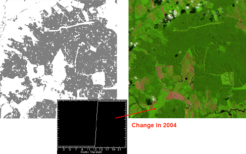
Left: forest / non-forest map, 23 July 2007. Right: Landsat 5 TM image of the same date.
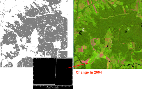
Left: forest / non-forest map, 23 June 2008. Right: Landsat 5 TM image of the same date.
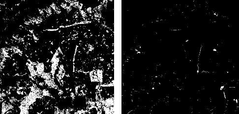
Left: forest change from 29 July 1986 till 23 June 2008. Right: forest change from 23 July 2007 till 23 June 2008.
DISCLAIMER: Please note that the results shown here have not been verified with in-situ data or very high resolution satellite images, so they have an unknown misclassification rate.