Grøntstruktur
Grøntstruktur
Urban green structure mapping by satellite images
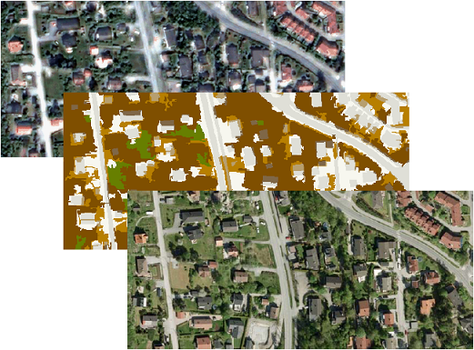
The management of urban green structure has received much attention lately in the research community. The project was initiated to meet the need of municipalities in Norway to develop a green structure plan. Traditional mapping has its limitations, since the land use is in focus and not the actual land cover. Therefore, other sources of information about urban and suburban green structure are being sought.
Asplan Viak AS, with co-funding from the Norwegian Space Centre, develops a prototype service for monitoring urban green structure, with the Norwegian Computing Center as a subcontractor. In phase one of the project, Asplan Viak developed an automatic classification method, implemented in Definiens Developer. The Norwegian Computing Center performed an evaluation of the detection result.
Contact information

Project period
Financing
Norwegian Space Centre