EnviSnow
EnviSnow
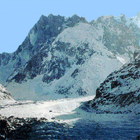
Snow cover has the largest area extent of any component of the cryosphere (the portions of the Earth's surface where water is in a solid form) and most of the Earth's snow-covered area is located in the Northern Hemisphere, where the mean snow-cover extent ranges from 46.5 million km² in January to 3.8 million km² in August. The temporal variability is dominated by the seasonal cycle. However, changes in the annual spatial distribution of snow have been observed during the last decades related to the climate change.
The terrestrial cryosphere plays a significant role in the global climate, in climate response to global changes and as an indicator of change in the climate system. However, a better understanding of the interactions and feedback of the land/cryosphere system and their adequate parameterization within climate and hydrological models are still needed.
 In the mountainous areas and in the whole North of Europe snowfall is a substantial part of the overall precipitation. The amount and timing of snowmelt runoff from snow and glaciers is important information for management of water resources, including flood prediction and hydropower operations in Scandinavia, the Alps, USA, Canada and New Zealand. A number of hydrological models for monitoring and runoff forecast are used throughout Europe, many of which, in principle, can be updated by earth observation data. Many of them are capable of forecasting and simulation of snowmelt induced flooding. A major problem with the use of these models is the lack of information on the spatial distribution of model parameters and variables. Future progress in hydrological modelling and water management is expected to be achieved by using distributed hydrological models which match the distributed information from field campaigns and in earth observation. The availability of adequate remote sensing data is essential for model development and validation in hydrology.
 Satellite-based remote sensing instruments have shown to be an efficient tool for monitoring of snow parameters. The current available snow products are based on single sensors, thus the temporal and spatial limitations are given by the single sensor characteristics. Full operational utilisation of optical sensor products has so far been limited by the cloud cover. For the end users to be able to utilise remote sensing data in operational monitoring and management of snow, the data must meet the temporal and spatial resolution and accuracy requirements. But above all, the guaranteed availability of the products must be ensured before any regular operational service can be established.
The upcoming launch of ENVISAT will for the first time provide the user community with simultaneous imaging capability of the same ground area with both optical (MERIS and AATSR) and multiparameter SAR (ASAR). This true multisensor imaging capability makes it possible to develop, validate and bring into operational use multisensor and multitemporal algorithms and products applicable both for regional and global mapping.
Contact information

Project period
Financing
The European Commission